SPECIAL BULLETIN: #1 VALID UNTIL: Thursday, November 14, 2018
DATE ISSUED: Monday, November 12, 2018 TIME ISSUED: 04:00PM
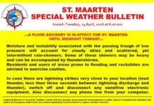
…A HEAVY RAINFALL ADVISORY IS IN EFFECT FOR ST. MAARTEN…
Abundant moisture and instability associated with an approaching active tropical wave (invest 96L) will produce unstable weather conditions across the region from Early Tuesday November 13th through Thursday November 15th 2018.
As the system approaches the area, there is an increased possibility for showers and thunderstorms accompanied by gusty winds over the local area. Some of these showers may be heavy and will lead to localized flooding over sections of the island.
Residents in low-lying areas should be vigilant and take the necessary precautions as soils are already saturated. Motorists should avoid driving on flooded streets until the heavy rainfall has tapered off or ended and the floodwaters have receded.
In case there are lightning strikes very close to your location (loud thunder, less than three seconds between lightning discharge and thunder), switch off and disconnect any sensitive electronic equipment. Also, disconnect any phone line from your computer.
Meteorological Department St. Maarten will continue to monitor the situation and keep the public informed through special bulletins.
The next update will be issued at 6:00 am Tuesday November 13th 2018.
FORECASTER: CONNOR
Source: Meteorological Department St. Maarten


