


 expands to Sint Maarten with first grant awarded to future Alvin Ailey Dancer")


")
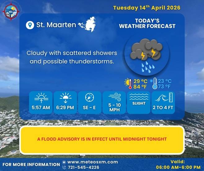
SPECIAL WEATHER BULLETIN
DATE ISSUED: Tuesday, 14 April, 2026 TIME ISSUED: 6:00 AM
… A FLOOD ADVISORY IS IN EFFECT FOR ST. MAARTEN
UNTIL MIDNIGHT TONIGHT…
Moisture and instability associated with the passing trough of low pressure will account for cloudy skies and scattered, yet intermittent rain-showers. Some of these showers may be heavy and can be accompanied by thunderstorms. Caution is still advised in low-lying and flood-prone areas due to possible street-flooding and/or rock-slides throughout the day.
In case there are lightning strikes very close to your location (loud thunder, less than three seconds between lightning discharge and thunder), switch off and disconnect any sensitive electronic equipment. Also, disconnect any phone line from your computer.
FORECASTER: Connor
Definitions:
A Special Bulletin is issued for weather events that are unusual, cause general inconvenience or public concern (requiring the attention and action of emergency authorities) and cannot adequately be described in a regular weather forecast.
A Precautionary statement means that there is a slight possibility (< 30% chance) of occurrence within the next 8 to 24 hours.
A Heavy Rainfall Watch/Alert is an announcement when heavy rainfall is evident within the following hours.
A Heavy Rainfall/Flood Advisory is an announcement when heavy rains are about to occur or occurring already, but are not strong enough to require a warning.
A Heavy Rainfall/Flood Warning is an announcement when heavy rains are about to occur or are occurring already.


